National Highways
Twelve Minecraft worlds spanning four major UK road projects. From the A428 expansion to the Lower Thames Crossing — we turned architectural drawings and geospatial data into playable worlds that 2,500+ consultees and classrooms across the country have explored.
Explore the 12 Games ↓Putting Major Road Projects in Players' Hands
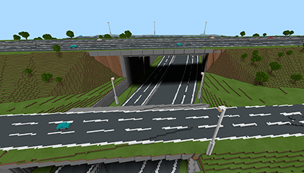
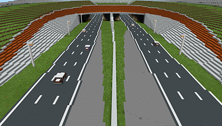
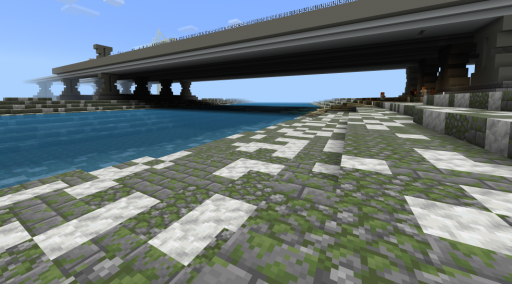
National Highways operates, maintains and improves the country's motorways and major A roads. When they needed to consult communities about the A428 Cambridge-to-Milton-Keynes upgrade in summer 2019, they asked BlockBuilders for something different: an in-Minecraft version of the proposed road that residents, schools, and parents could walk through before a single shovel hit the ground.
The A428 build was, at the time, our largest Minecraft world ever. An in-game traversal takes 90 minutes (about half the real-world drive). Over eight weeks we delivered primary school workshops, remote digital access, a laptop-and-VR suite at 12 public events, and reached 2,500+ attendees across the East of England. That partnership has since grown into a 13-game portfolio spanning four major road projects.
Architectural Drawings to Playable Worlds
Each project begins with the same challenge: take the engineering reality — geospatial surveys, architectural plans, ecological assessments, historical research — and translate it into something an eleven-year-old will willingly spend an hour exploring. Every world ships with KS2 and KS3 lesson plans so teachers can drop it straight into a curriculum.
Across the four projects we've built consultation worlds, biodiversity simulations, creative build-your-own sandboxes, heritage journeys, road-safety challenges, and tunnel-engineering simulations. Each is downloadable for free via our GitHub — the click-path is: download the world, install, open in Minecraft Education, play.
A428 Expansion
The project that kicked everything off. A 90-minute walkable scheme world, built from geospatial data for the 2019 public consultation, plus two follow-on classroom releases: an ecology-focused biodiversity game and an open creative build.
A303 — A Road Through History
The A303 runs past one of the most important prehistoric monuments on Earth. Three games explore the tension between moving traffic and protecting a World Heritage Site: a time-travel journey, an ecologist simulation, and a creative sandbox.
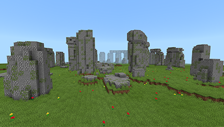
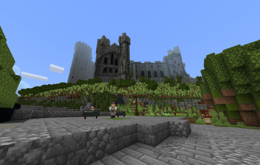
Stonehenge — Through the Ages
Travel through Stonehenge's timeline. Understand why the landscape around the A303 matters and how the proposed tunnel aims to protect it.
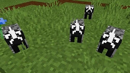
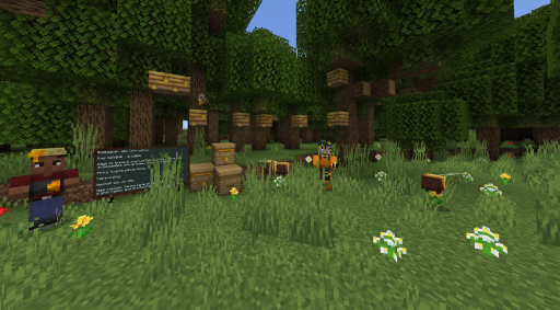
Biodiversity — Be an Ecologist
Step into the shoes of a working ecologist. Survey species along the A303 corridor and make real-world mitigation decisions.
A303 Creative
A Stonehenge-adjacent sandbox — redesign the road, site, or surrounding landscape however you see fit.
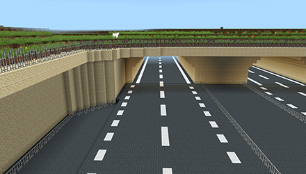
The UK's Biggest Road Project
The Lower Thames Crossing is a 14.3 mile route linking Kent, Thurrock, and Essex — including the longest road tunnel in the UK. Three games cover the engineering, safety, and community decisions behind one of the most ambitious infrastructure projects in a generation.
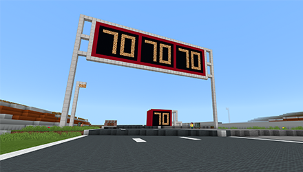
Speed & Safety
Understand how speed limits, road design, and driver behaviour interact. A road-safety challenge built on the LTC scheme.
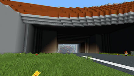
Tunnel Digging
Take a tunnel-boring machine under the Thames. Experience the engineering challenges of the UK's longest road tunnel.
LTC Creative
An open sandbox set along the crossing route — design your own tunnel, viaducts, and community infrastructure.
A27 — Road, Heritage, and Ecology
The A27 runs through the South Downs and some of the most sensitive landscape in southern England. Four games cover history, biodiversity, viaduct engineering, and road signage — the widest scope we've delivered for a single scheme.
A27 History
Trace the A27 corridor through history — Roman roads, medieval routes, and modern upgrades.
A27 Biodiversity
Survey South Downs ecology and understand how road upgrades can protect — or threaten — sensitive habitats.
A27 Viaduct
Design and build a viaduct that works for both drivers and the landscape it crosses.
A27 Road Signs
Learn the grammar of British road signage — shapes, colours, meanings — and design signage for a stretch of the A27.
Learning Objectives & Curriculum
Learning Objectives
- Understand how major infrastructure projects are planned and consulted
- Evaluate trade-offs between development, heritage, and biodiversity
- Read and interpret road signage, plans, and geospatial data
- Explore careers in civil engineering, ecology, and planning
Curriculum Links
- KS2–3 Geography (land use, infrastructure, environment)
- KS2–3 Design & Technology (engineering, problem solving)
- KS2–3 Science (ecology, biodiversity)
- Citizenship (public consultation, community decision-making)
Skills Developed
- Spatial reasoning and map literacy
- Evidence-based decision-making
- Collaborative building and design
- Career awareness in infrastructure and ecology
Explore & Play
Planning a consultation or infrastructure project?
We turn engineering plans and geospatial data into Minecraft worlds that communities actually engage with.
Start Your Project →